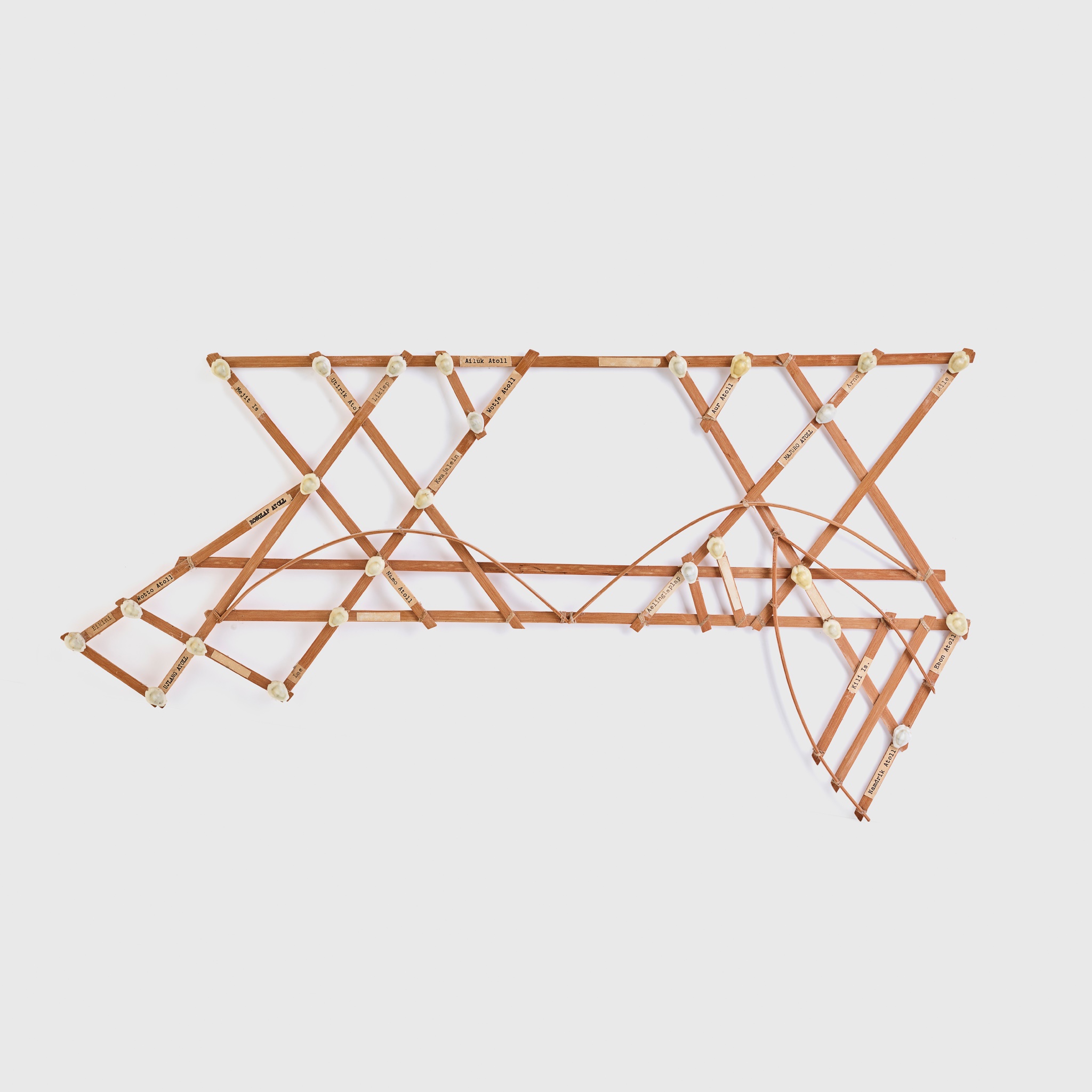
Description
wood, fibre and snail shells, the bound sticks representing the movement of the ocean between islands, with typed labels next to each shell
Dimensions
Footnote
Provenance:
Private collection, United Kingdom
Adam Prout, United Kingdom
Note:
"The curator and scholar Sean Mallon has observed that 'for generations of indigenous navigators, finding, travelling and living among these islands was not a matter of chance, it was a necessity of life, an act of imagining, knowing and remembering the ocean.' Although navigational knowledge was conveyed in many ways, the stick charts of the Marshall Islands have become famous expressions of indigenous geographic understanding. They are not maps as such, but devices that represent patterns in the ocean swell, which together with the movements of birds and stars were amoung the vital reference points for the local mariners who undertook voyages of settlement and trade. They were aids to memory and teaching teaching devices, and of many kinds." (Peter William Brunt et al., 2018).