

Lot 125
Black, Adam & Charles (publishers)
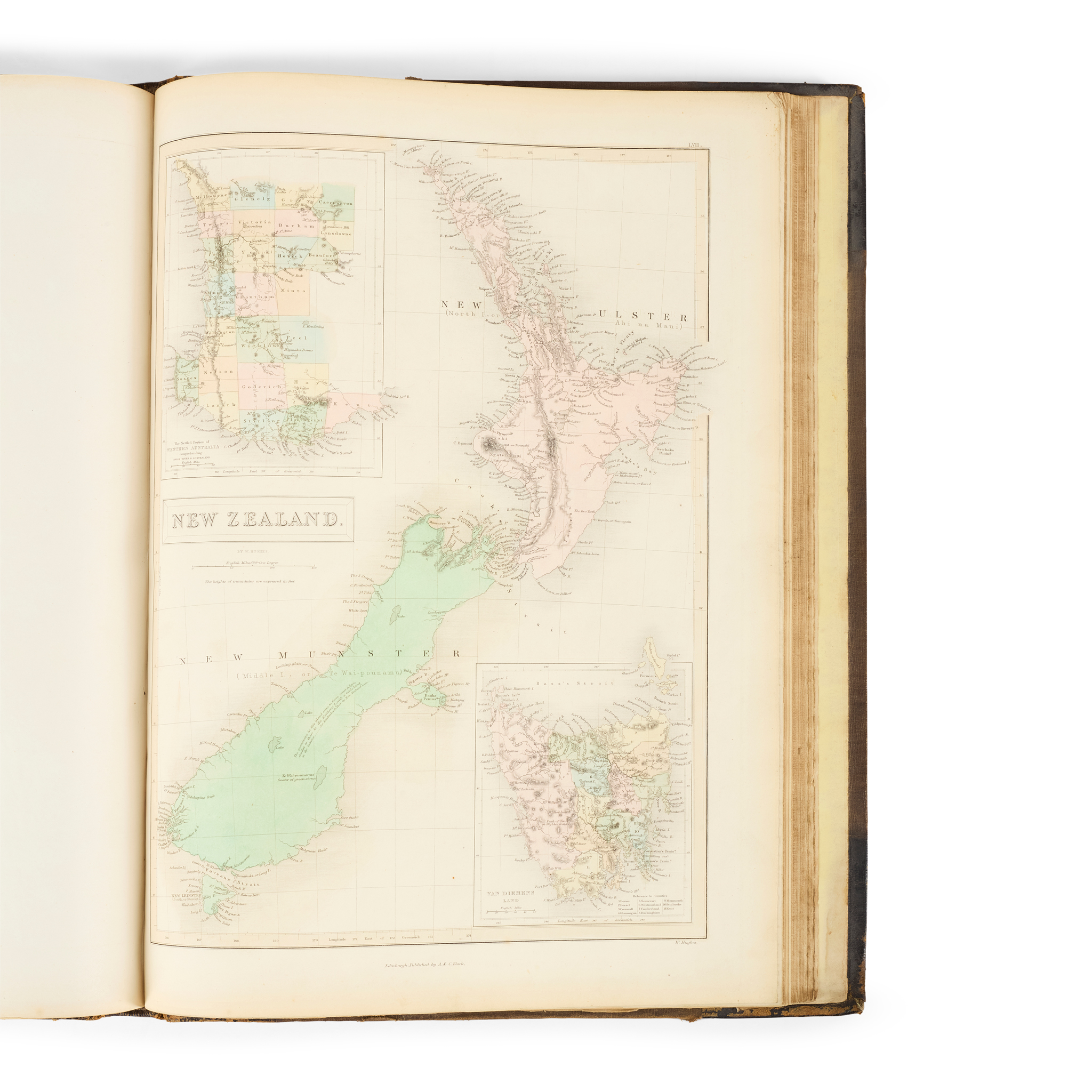
Black's General Atlas
Auction: 16 June 2026 from 10:00 BST
Description
Edinburgh: Adam and Charles Black, 1851. Folio (44 x 32cm), original black half morocco, 55 engraved maps numbered 1-60 (including two maps numbered 3, and 6 double-page maps each counted as 2 separate maps in list of contents), most hand-coloured, a few maps with guard strengthened with linen tape, wear to extremities of binding, cloth cockled, cloth on front board lifting at foot;
Johnston, W. & A. K. (publishers). Colonial Atlas of Oceania. Edinburgh: W. & A. K. Johnston, 1886. First edition, tall 8vo (29.6 x 18.6cm), original cloth-backed printed card boards, letterpress title-page, 13 wood-engraved maps printed in colours, loose in binding, many with short split to foot of central fold, a few small nicks elsewhere;
Bowen, Thomas. [Five charts from Bankes's New System of Geography], c.1790. [Comprising:] A New and Accurate Chart of of the Discoveries made by the late Capt. J[ame]s Cook, and Other Distinguished Modern Navigators … exhibiting Botany Bay, with the Whole Coast of New South Wales in New Holland, also New Zealand, Norfolk and the Various Other islands; A New and Complete Chart of the World displaying the Tracks of Capt Cook; A New and Accurate Map of Africa; A New and Accurate Map of Asia; A Correct Map of the Ottoman Empire. All 38 x 49.5cm or reverse, fraying to edges
Footnote
The maps in Black's General Atlas include China, the West Indies with an inset map of Jamaica, and the United States extending to the 93rd meridian west (i.e. the western borders of Louisiana, Arkansas, Missouri and Iowa), and New Zealand with the North and South Islands named as New Ulster and New Munster. The Colonial Atlas of Oceania is very rare, with Library Hub tracing one copy only, at the Royal Geographical Society.