Orkney and Shetland
Collection of engraved maps and charts, 17th to early 19th century
£756
Rare Books, Manuscripts, Maps & Photographs
Auction: 21 September 2023 at 10:00 BST
Description
Collins, Greenvile. 10 sea charts, c.1693 or later, approx. dimensions 51 x 62cm, all with numerous rhumb lines, several backed on additional sheet of paper apparently at or near date of issue, variable toning, charts comprising: The South Part of the Isles of Shetland (hand-coloured); Part of the Maine Island of Shetland, 2 copies (both hand-coloured, decorative title cartouches); The Islands of Orkney (2 copies, one hand-coloured, decorative title-cartouches, coloured copy with damp-staining along top edge, uncoloured copy browned); The East Coast of Scotland with the Isles of Orkney and Shetland (hand-coloured, reinforced verso along central fold); The Cheife Harbours in the Islands of Orkney (4 copies, each with 2 inset maps and a panel of coastal profiles inset, decorative title cartouches, one hand-coloured);
Mackenzie, Murdoch. Carte des îles Orcades et de la côte nord d'Ecosse ... réduite des plans de Mackenzie et publiée par ordre du Contre-Amiral Decrès Ministre de la Marine et des Colonie. Paris: Dépôt général de la Marine, An XII [1803/4]. 63 x 92 cm, rhumb lines, inset map of Shetland and coastal profiles, hand-coloured, central fold;
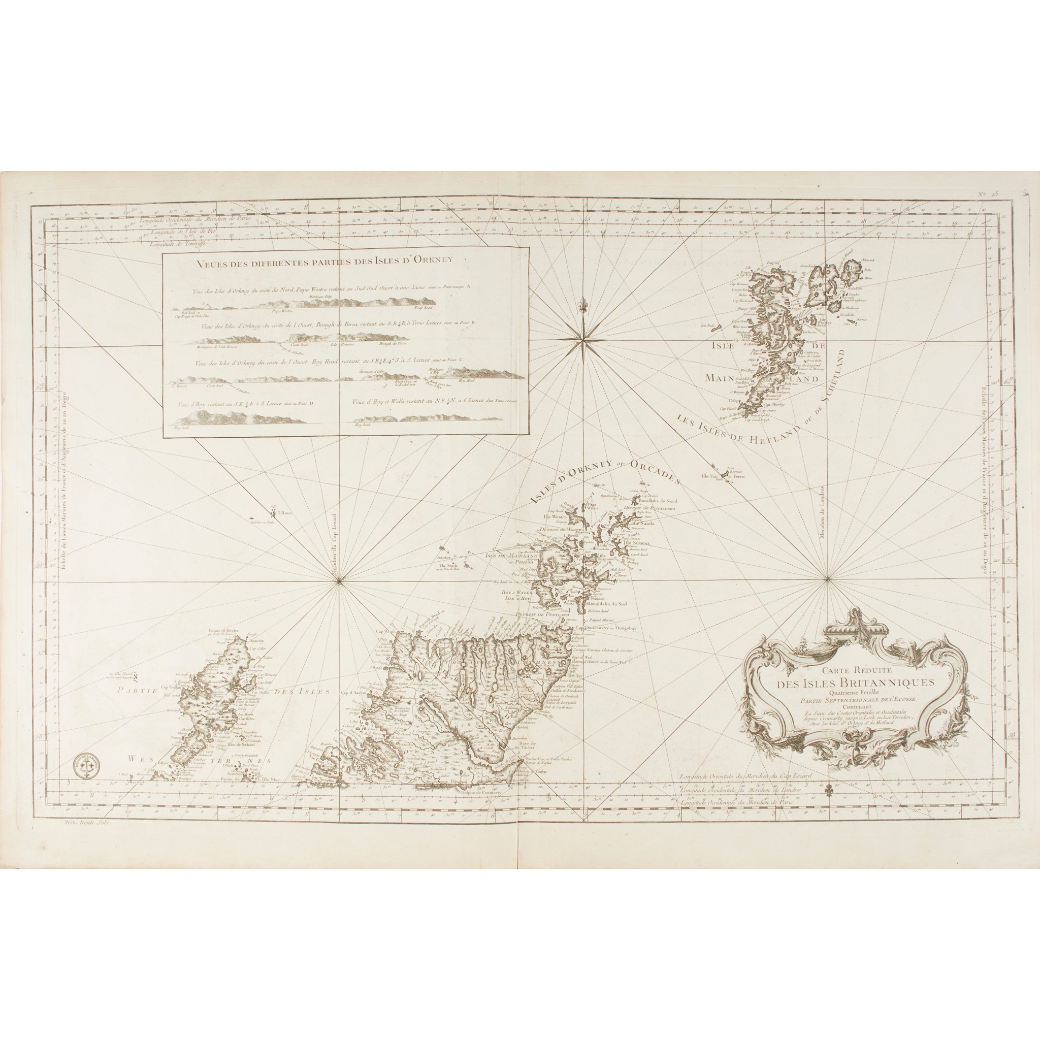
[Bellin, Nicolas]. Carte réduite des isles Britanniques. Quatrième feuille. Partie septentrionale de l'Ecosse, [Paris], 1757. 64 x 92cm, rhumb lines, decorative title cartouche, inset panel of Orkney coastal profiles, central fold;
Sanson, Nicolas. Les isles Orcadney ou Orkney; Schetland, ou Hetland; et de Fero, ou Farre, tirées de divers memoires. Paris: Pierre Mariette, 1669. 55 x 72cm, decorative title cartouche, central fold;
and 4 others similar