Lot 303

Thomson, John & Co.
The atlas of Scotland
Auction: 8 February 2006 at 11:00 GMT
Description
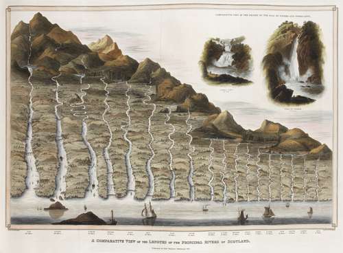
containing maps of each country, and places of importance ... laid down from actual survey. Large folio, (54.5 x 41.5 cms.), index map as frontispiece (hand coloured in outline), 2 folding. hand coloured panoramas, the one of the heights of the principal mountains, the other the length of the rivers, 29 maps, hand coloured in outline and with engraved topographical vignettes, town plans, etc., on 58 sheets of which several are joined together, contemporary half calf, paper boards, partial split of the lower joint, occasional light offsetting, lower margin of the map of Linlithgowshire slightly dusty and frayed, some light stain marks in the outer margins of the map of Buteshire, occasional slight cropping of the plate marks, in a couple of instances touching the imprint, otherwise a fine copy.
Note: Chubb p. 388 no xxxii; Moir I p. 129 & II p. 154 no 11; Tooley p. 91. The publication of this atlas, described by Tooley as "the finest county atlas of Scotland in the nineteenth century", was spread over the years 1820 to 1830 with the maps being sold in loose sheets when completed. Its cost lead to the publisher's bankruptcy. The scale of the maps of almost one and a half miles to an inch resulted in the most detailed map of Scotland prior to Ordnance Survey. An interesting feature is the provision on the maps of the names of the various surveyors and others involved in their compilation attesting to their accuracy. A corrected edition was brought out in 1869 by Lizars in 4to.