Lot 121
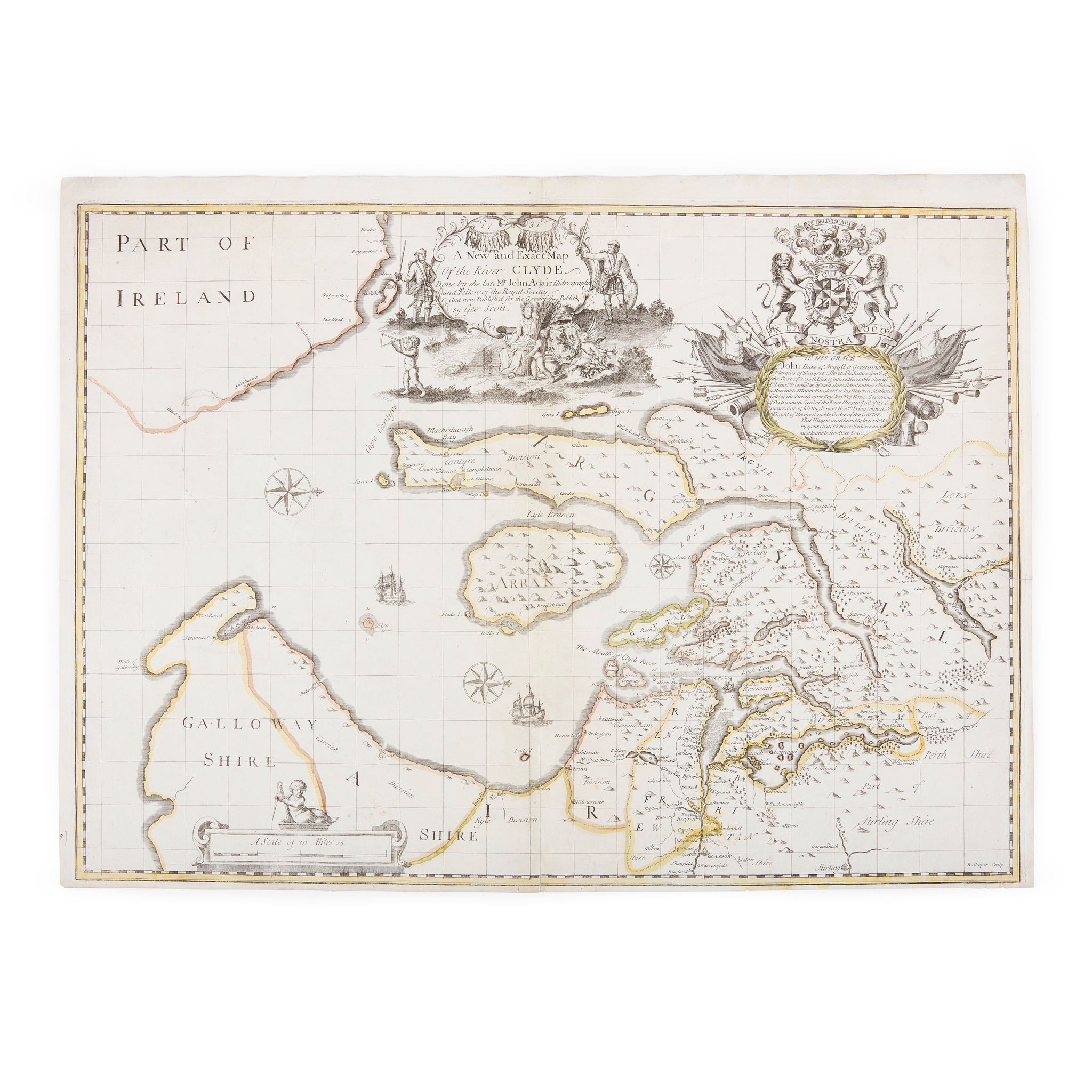
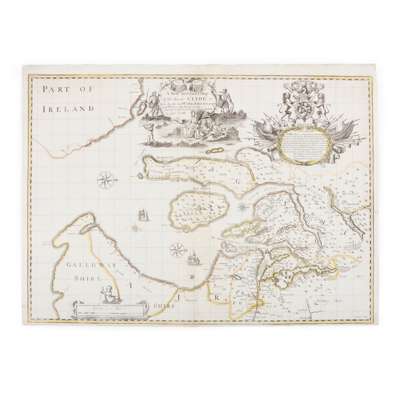
Adair, John
A New & Exact Map of the River Clyde
Auction: Books & Manuscripts | Wed 25 February from 10am | Lots 63 to 255
Description
[No place:] Geo. Scott, 1731. Engraved map by Richard Cooper after John Adair, oriented to the west, on two conjoined sheets, 51 x 70cm, hand-coloured in outline, decorative title cartouche and dedication to John Campbell, 2nd Duke of Argyll (commander of Hanoverian forces during the 1715 Jacobite Rebellion), compass roses, two small vignettes of ships at sea, neat repairs to verso [RSGC, The Early Maps of Scotland to 1850, 3rd edition, 1983, volume 2, p. 14]
Footnote
A very rare map of the Clyde estuary, Argyll and the west coast of Scotland, with a number of striking decorative flourishes. John Adair (d. 1718) was ‘an eminent Scottish surveyor and map-maker … Between 1682 and 1688 he drew a series of maps of the Scottish counties, but most of these were not published until after his death’ (Chubb, p. 419). This appears to be the first and only edition; it was not included in Adair's unfinished work, The Description of the Sea Coasts and Islands of Scotland, which appeared in 1703.