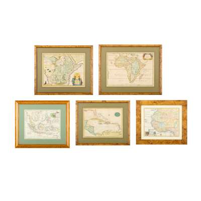
Lot 110

Africa, West Indies, East Indies
Collection of maps, mainly 17th-18th century
Auction: Books & Manuscripts | Wed 25 February from 10am | Lots 63 to 255
Description
all engraved, hand-coloured, mounted, framed and glazed (not examined out of frames; dimensions given are for mount apertures):
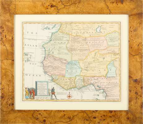
Bowen, Emanuel. A New and Accurate Map of Negroland and the Adjacent Countries; also Upper Guinea. [London], c.1750. 35 x 43.5cm, evidence of repair to foot of central fold;
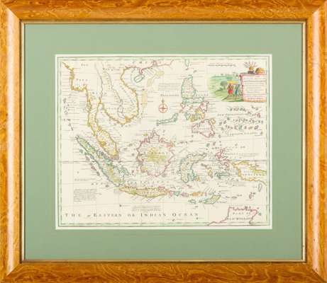
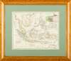
Ibid. A New and Accurate Map of the East India Islands. [London], c.1750. 34.5 x 43cm;
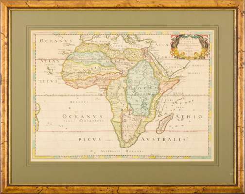
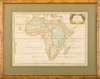
Sanson, Nicolas. Africa vetus. Paris: apud autorem, 1650. 40 x 56cm, slightly browned;
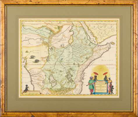
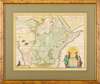
[Blaeu, Willem Janszoon]. Aethiopia superior vel interior; vulgo Abissiniorum sive Presbiteri Joannis imperium. {Amsterdam, c.1640]. 40 x 50.5cm;
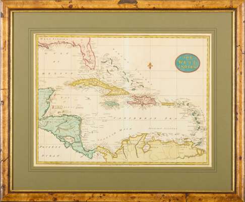
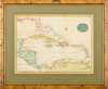
Stockdale, John. The West Indies. London, 1800. 35.5 x 47.5cm, light browning and offsetting;
Moll, Herman. A Map of Zaara. Negroe-Land. Guinea, etc. [London], c.1700. 17.5 x 21cm, browning;
[Bellin, Jacques-Nicolas]. Carte de l'entrée de la riviere de Sierra Leona, c.1764. 22 x 18cm;
Basire, Isaac. A Map of the Coast and Country about Sierra Lione and Sherbro River, c.1745. 22.5 x 16cm (8)