COLONEL JAMES ALEXANDER GRANTE (ACTIVE 1745-6)
RARE JACOBITE MAP OF GREAT BRITAIN 1745-6, PUBLISHED CIRCA 1749
£5,000
Scottish Works of Art & Whisky
Auction: 18 August 2021 at 11:00 BST
Description
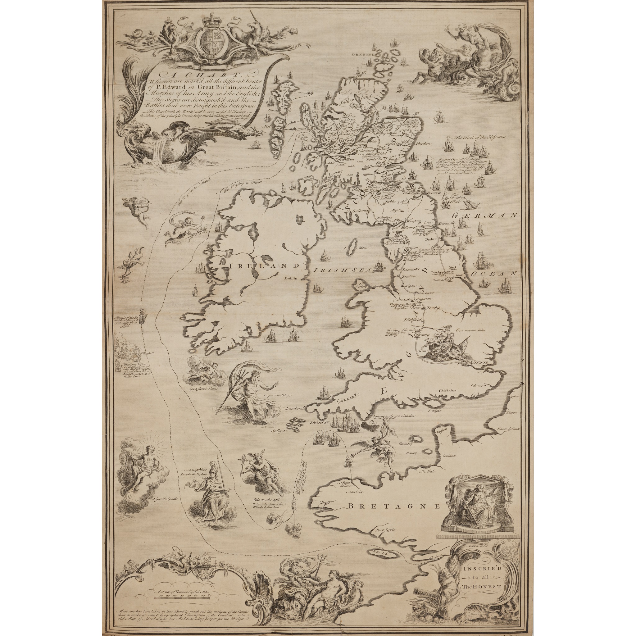
engraving and etching, printed on paper, being a map of the routes, battles and sieges of the campaign of Prince Charles Edward Stuart in Great Britain, 1745-6 (Jacobite Rebellion (1745-6)), titled A CHART/ Wherein are mark’d all the different Routs of P. Edward in Great Britain, and the Marches of his Army, and the English. The Sieges are distinguish’d, and the Battles that were Fought in this Enterprise [process]/ This Chart with the Book will be very useful in History, the Dates of the principle Events, being marked with the greatest care and exactness./ More care has been taken in this Chart to mark out the motions of the Armies / than to make an exact Geographical Description of the Counties: An / old Map of Morden was our Model, as being proper for the Design. INSCRIB’D – to all –The HONEST
Dimensions
63.7cm x 41.5cm
Provenance
Provenance: Property from Tornaveen House, Aberdeenshire
Footnote
Note: This map, a reduced version of a larger map held in the Royal Collection, was issued folded inside a ‘Book’ which is referred to in the title. The ‘Book’ is a small explanatory text entitled: ‘A / Description / of a / chart / wherein are marked out / All the different Routes / of / Prince Edward / in / Great Britain / and the Marches of his Army and the / E - gl - sh.’ According to Blaikie p.106, it was published in 1749. A description of the map and booklet is given in Shirley 1988, pp.63-4. Shirley records no variant states for this map which is thought to have been a proof and therefore very few copies would have been seen by the public.
Copies of this map are held in the Royal Collection (RCIN 729135); and The National Archives, Kew (TNA MPF 1/2 extracted from SP 36/79.)