BANNERMANS OF ELSICK AND ABERNETHIE OF CRIMONMOGATE, ABERDEENSHIRE SALEROOM NOTICE: ESTIMATE IS NOW £4,000-6,000
MANUSCRIPT ESTATE PLANS AND MAPS.
£4,000
Rare Books, Manuscripts, Maps & Photography
Auction: 31 January 2019 at 11:00 GMT
Description
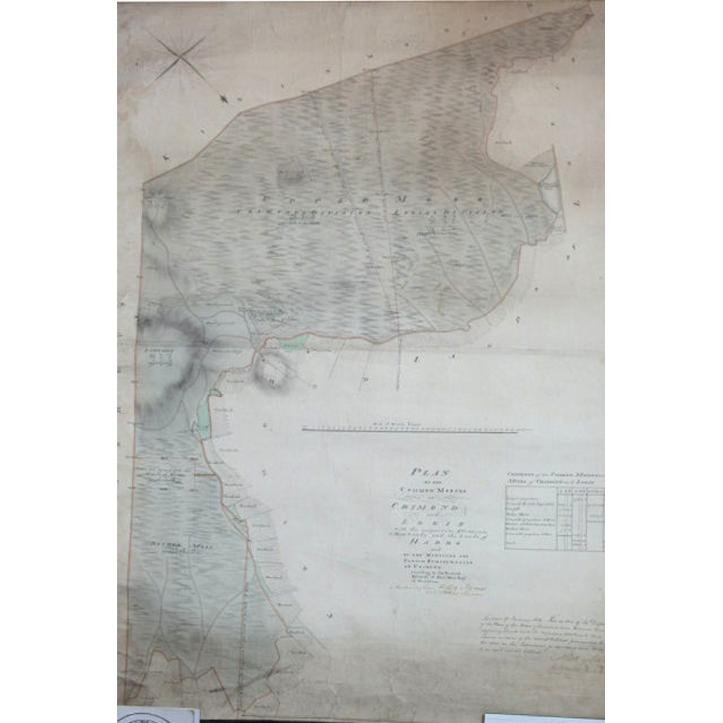
Manuscript Plan of the Lands of Crimonmogat whereof Mr William Abernethie is Proprietor, made out from an Accurate Survey 1776 by Jo. Sangster, 270 x 130cm., hand-coloured manuscript map with inset view of the mansion of Crimonmogate, backed on linen, a few small tears at head without loss; Plan of the Lands of Crimonmogate, the Property of Chas. Bannerman Esq. by John Boulton, 1834, manuscript map,90 x 177cm., Manuscript Map of the Lands of Logie, surveyed by Walker and Beattie of Aberdeen, Nov. 1828, 151 x 84cm., backed on linen, torn with minor loss; Manuscript Sketch of the March betwixt Park & Crimonmogate, 14th March 1793, 33 x 54cm; Manuscript Plan of that part of the Longhill which was controverted between Alexander Fraser of Mormond, William Abernethie of Crimonmogate, Capt. Robert Duff of Logie and James Cumine of Kininmonth, according as it is now divided, 1770, 53 x 82cm, hand-coloured in outline, backed on linen, torn at fold; Manuscript plan of the Farm at Cairness, 113 x 70cm, [c.1790], manuscript plan, outline colouring, backed on linen; General Plan of Pitfours Estates by Jno. Sherar, asst. to John Boulton, 1823, manuscript map, 79 x 157cm, outline hand-colour, backed on linen; [Plan of] The Farm of Tillikira... the property of William Abernethy, 1766, manuscript plan, 53 x 76cm., manuscript notes by James Anderson, backed on linen, a few small tears without loss; Scroll Plan of the Moss and Muirs upon the Barony of Crimmonmogate... upon which Capt. Duff has a claim for the lands of Chanriehill by David Aitken, Surveyor, 1768, manuscript map, hand-coloured in outline, 76 x 76cm., torn with loss; Plan of the Common Mosses of Crimond and Logie, with the Respective Allotments to these lands according to the Decreet Arbitral of Alex. Moir of Scotstown, 1813, manuscript map, 104 x 73cm., some hand-colour, laid down on linen; Plan of the Lands of Logie, the Property of the Hon. Admiral Duff, copied from the Original by William Urquhart 1781, 195 x 87cm., manuscript map with cartouche incorporating an anchor and ship of the line, outline hand-colour, backed on linen, wear and some loss to corners; Plan of the Estates of Crimonmogate & Logie, belonging to Sir Alexander Bannerman Bart, in the parishes of Lonmay and Crimond and the County of Aberdeen, surveyed by Lewis, 1852, 198 x 155cm., backed on linen; and several plans for barns and outbuildings (quantity)