Lincolnshire Maps - A Large Collection including Speed, John
£800
Rare Books, Manuscripts, Maps & Photography
Auction: 17 May 2017 at 12:00 BST
Description
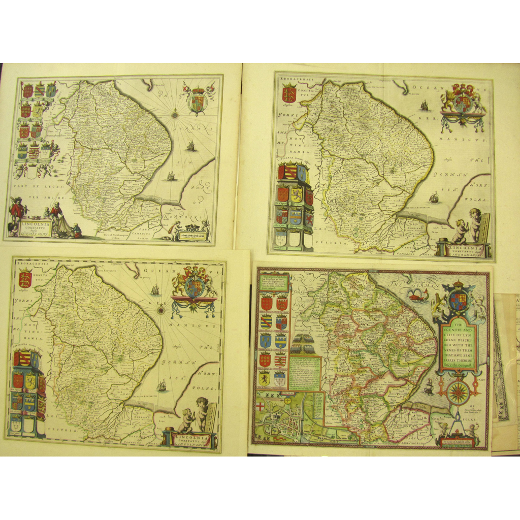
The Countie and Citie of Lincolne described. [1610], Double-page engraved map, 2 copies, coloured and uncoloured, (coloured copy strengthened on verso with slight split, no loss), English text on verso, (414 x 536mm.); Bowen, Emmanuel. An Accurate Map of Lincolnshire.. for R. Sayer, T. & J. Bowles, 1750, (727 x 560mm.); A New Map of the County of Lincoln. London: C. Smith, 1801, (650 x 518mm.); Blaeu, Johannes Lincolnia Comitatus. Anglis Lincoln-shire. [c.1648 and 1670], 3 copies, hand-coloured double page maps, one with Dutch text on verso, one with French text on verso, one with no text on verso (641 x 528mm.); Bowen, E. An Accurate map of Lincoln Shire. Printed for T. Kitchin, hand-coloured in outline, (575 x 460mm.); Cary, J. A Map of Lincolnshire. J. Stockdale, 1805, 2 copies, (580 x 482mm.); Mordern, Robert Lincolnshire. 3 copies, (417 x 490mm.); Ogilby, John The Road from Nottingham to Grimsby, hand-coloured engraved strip map, (380 x 453mm.); Saxton, C. & W. Kip. Lincolniae Comitatus, [c.1710], uncoloured, (320 x 370mm.); Walker, J. & C. Lincolnshire. Longman [&c.], 1835, hand-coloured map, 420 x 345mm.); Kitchin, T. Lincolnshire drawn from the best Surveys & Maps, hand-coloured in outline; and 32 small later maps or road maps relating to Lincolnshire, and 11 miscellaneous later maps