Lot 16
Speed, John and Peter Keer
[Volume of miniature maps of Scotland and Ireland]
Rare Books, Manuscripts, Maps & Photographs
Auction: 21 September 2023 at 10:00 BST
Description
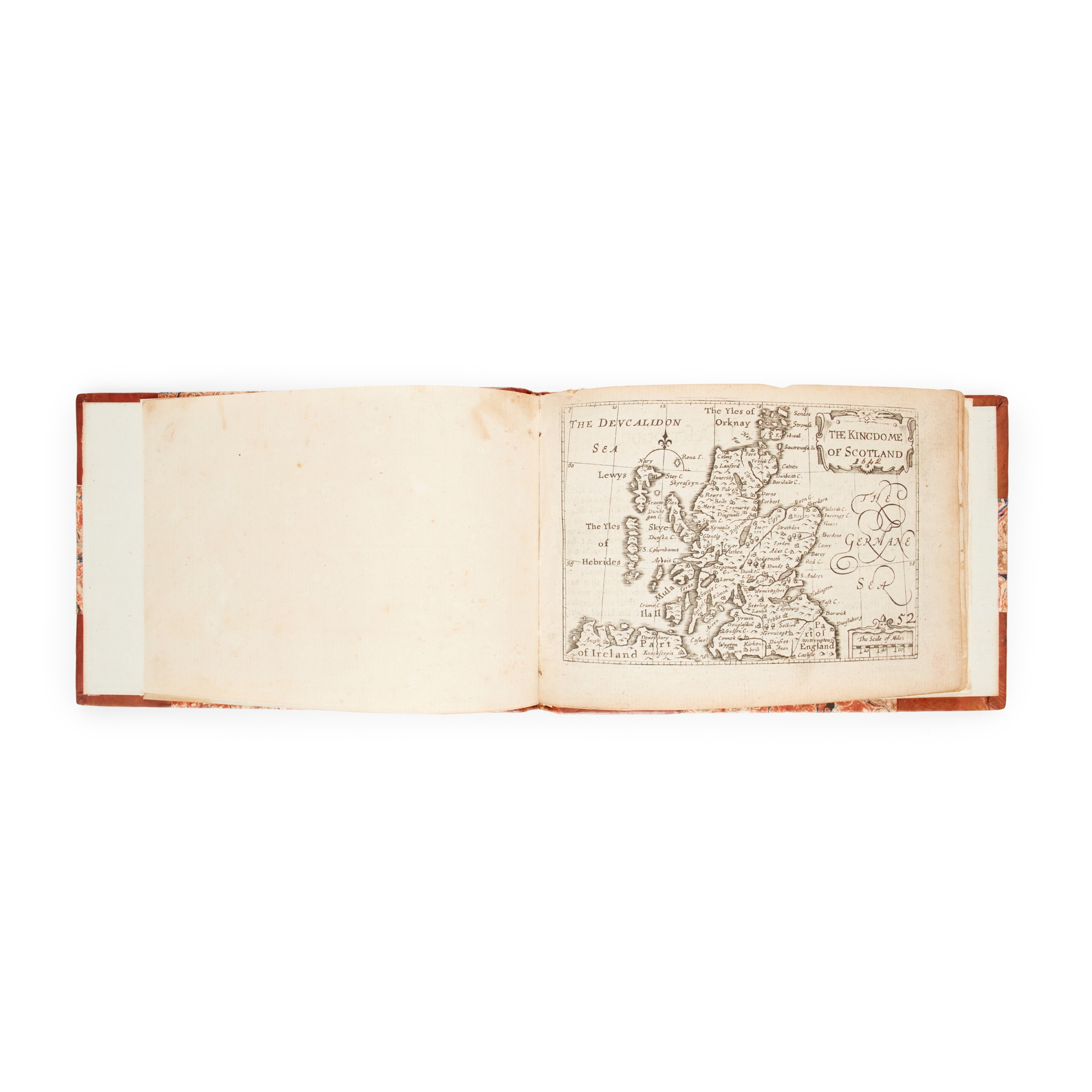
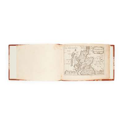
[London, c.1650]. Oblong 12mo (10.3 x 15.3cm), modern half calf, 12 engraved maps with text on versos, comprising: 1) The Kingdome of Scotland; 2) The South p[ar]t of Scotland wherin are contayned Edinbrough, St Andrew and Glasco; 3) The Southern parte of Scotland, wherin is ye strange Lake Lomund; 4) The Eastern Part of Scotland wherin ther are divers Shires and the University of Aberdyn; 5) Part of Scotland it is called of the inhabitance Stranaverne with his borderers; 6) The Isles of Hebrides wth ther borderers; 7) Cathanes and Orknay Ins[ulae]; 8) The Kingdome of Irland; 9) Mounster; 10) Linster; 11) Connack; 12) Ulster. Light bronwing, very shallow chip to top edges, 'The South p[ar]t of Scotland with minor loss to lower fore corner, a few marks.
Together with: John Cary, [Cary's New map of England and Wales with part of Scotland ... Delineated from Actual Surveys and materially assisted from Authentic Documents liberally supplied by the ... Post Masters General, London: J. Cary, 1794], 4to (30.2 x 24.5cm), contemporary marbled boards, rebacked and recornered, engraved dedication leaf, 14 + 88 pp. letterpress, engraved hand-coloured general map, 'Explanations' leaf (numbered 72), 45 maps hand-coloured in outline, lacking title-page and at least sheet numbers 16, 23-26, 33-6, 40, 43, 51-2, 58, 62-9, sheet 57 loose [ESTC N48119, 9 copies in libraries world-wide].
Sold as a collection of maps not subject to return