Lot 36
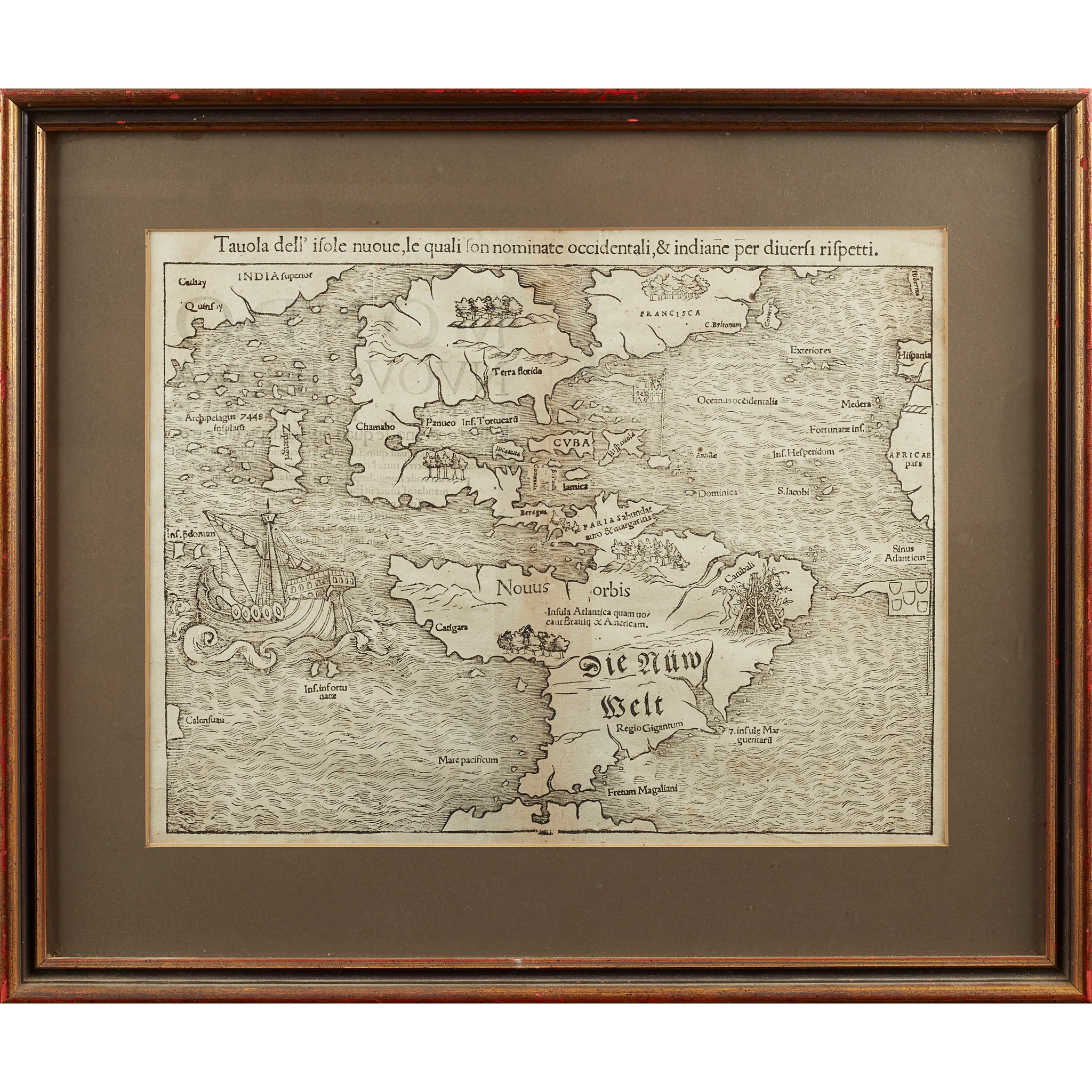
Münster, Sebastian
Tavola dell' Isole Nuove, le quali son nominante occidental, & indiane per diversi rispetti
Rare Books, Manuscripts, Maps & Photographs
Auction: 19 February 2020 at 10:00 GMT
Description
[Basel, 1558], 37 x 29cm, eighth state with Latin text to reverse, framed and double glazed, a little darkening where centre-fold has been reinforced
Footnote
Note: Taken from the Italian edition of Münster's Cosmographia Universalis, this map (first published in Ptolemy's Geographia several years earlier) has the destinction of being the first map to show North and South America as continents, and the first European map to show Japan (labelled Zipangri). The map also features an infamous cartographic error, Verrazzano's Sea: a huge sea separating East and West Canada, reported by the explorer Giovanni de Verrazzano in 1524, from whose description Münster created the map.