Scots Magazine, The
£7,875
Rare Books, Manuscripts, Maps & Photographs
Auction: 2 September 2015 at 12:00 BST
Description
Containing a general view of the religion, politics, entertainment &c. in Great Britain. Volumes 1-62. Edinburgh: Sands, Brymer, Murray and Cochran, 1739-1800, 8vo, 95 engraved plates, maps and plans (of 105), some folding, [the lacking plates being Scottish views], volumes 1-15 contemporary half calf, 16-62 contemporary calf, armorial bookplates of William McCombie of Easterskene and Lynturk, red morocco lettering pieces, volume 1 worn, a few rubbed; sold as a periodical not subject to return, [further details on missing plates available on request]
Footnote
Note: A very attractive run of The Scots Magazine.
The Scots Magazine is believed to be the oldest magazine still in publication, although there have been several gaps in its publication history. It has reported on events from the defeat of the Jacobites through the Napoleonic wars to the Second World War and on to the creation of the new Scottish Parliament. It was first published on 9th February 1739, as a 48-page pamphlet, priced sixpence monthly, and was edited and printed in Edinburgh.
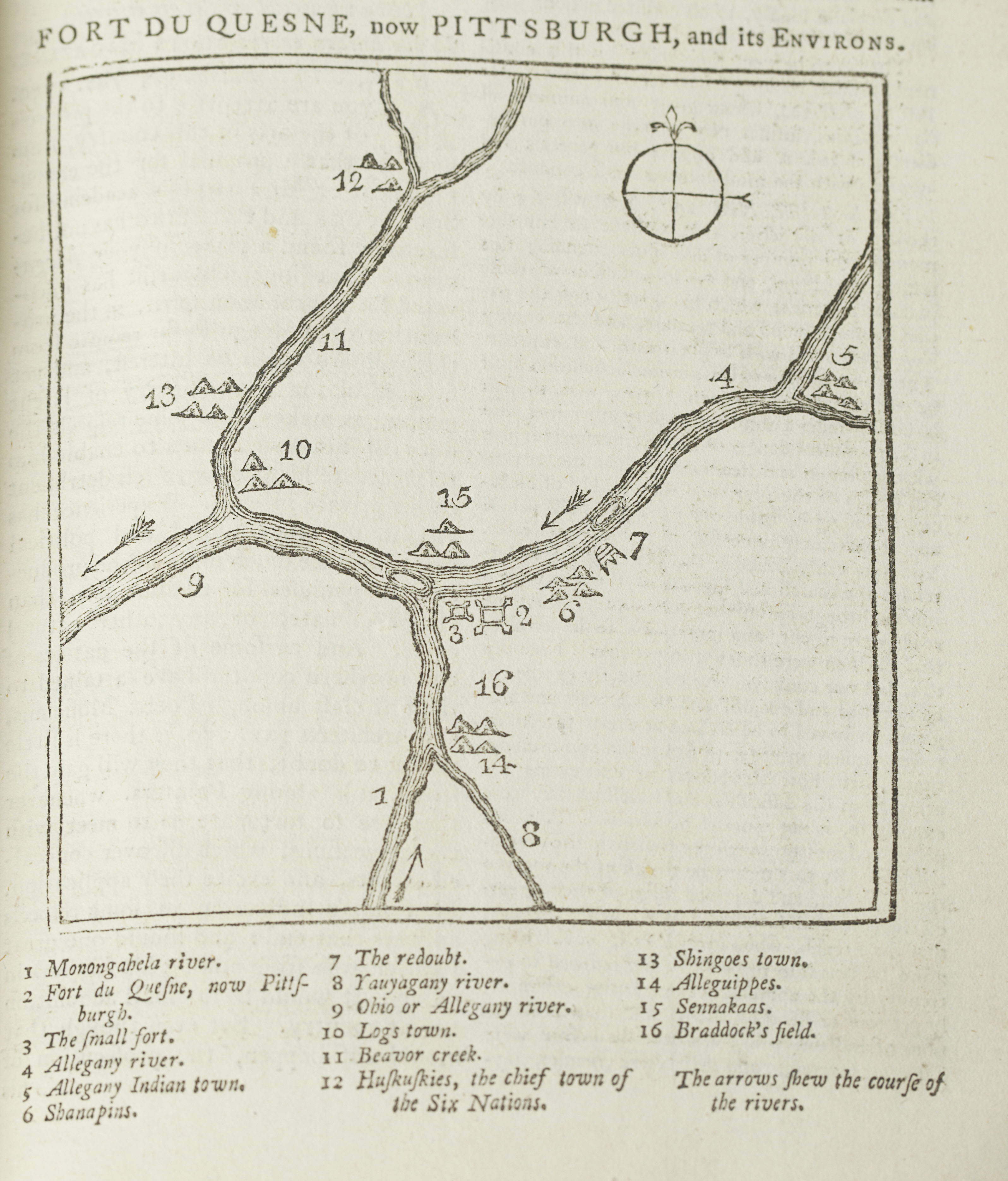
Volume 21, for 1759, details the skirmish between the English and the French that led to the burning of Fort Duquesne in late November, 1758, and the renaming of the settlement after William Pitt as "Pittsburgh". The woodcut map in the text is considered to be the first published map showing Pittsburgh renamed.
Volume 38, for 1776, reports "The Congress, on the 4th of July, declared the colonies independent states" and reproduces in full the Declaration of Independence (p.433-436).
Volume 53, for 1791, contains the account of the first British settlement in Australia, with "Extracts of letters of Governor Phillip, dated Sydney Cove, Feb. 13 1790, giving an account of the proceedings of the Colony at Botany Bay".
A letter from John Grant booksellers, dated 20 June 1945, loosely inserted in volume 2, notes that "the scarce portion of "The Scots Magazine" runs from about 1810 to the termination in 1826".
A full collation of the plates and maps is available on request.