Lot 31

Maps-Africa--Jannson, Jan.
Rare Books, Manuscripts, Maps & Photographs
Auction: 5 September 2007 at 12:00 BST
Description
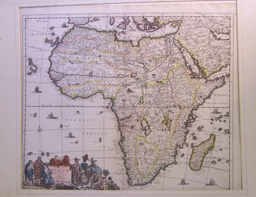
Nova Barbariae descriptio. Amsterdam, 1660, 43 x 53.5cm, 17cm. split at centre fold without loss, clean; Ortelius, Abraham. Barbariae et biledulgerid, nova descriptio. [Antwerp, 1588], engraved map, tipped into mount, 51.5 x 40cm, clean; Ortelius, Abraham. Barbariae et Biledulgerid, nova descriptio. [Antwerp, 1588], hand-coloured engraved map, loosely mounted, marginal tear just extending into shaded area above title, light discolouration around Corsica, 41 x 54.5cm; Arrowsmith, A. Africa, 2 (of 4) sheets [W and S.W.], 1802, each 65 x 76cm, light offsetting/spotting; Bellin, J.N. Carte reduite des costes occidentales d'Afrique, second feuille (only), Paris, 1753, 91 x 63cm, split at fold; Dunn, S. A map of Barbary, Laurie & Whittle, 1794, 34 x 48cm, hand-coloured in outline, slight discolouration to Morocco, mounted; de Wit, Frederick Totius Africae accuratissima tabula, authore I. Danckerts, Amsterdam, [1680], hand-coloured engraved map, 53.5 x 62cm, 10cm split at centre fold repaired neatly on verso; Bruce, James Plan of two attempts to arrive at the source of the Nile, engraved map, [no date], 51.5 x 33cm., clean; Aa, P. van der. Royaumes de Congo et d'Angola, hand-coloured engraved map, Leyden, 35 x 45cm; Guinée, hand-coloured engraved map, Leyden, 36 x 46cm; de l'Isle, G. In notitiam ecclesiasticam africae..., Paris, engraved by J. Senex, 52 x 68cm, discolouration and slight split at fold; and 4 others (17)