Lot 68
Moll, Herman.
Printed Books, Maps and Manuscripts
Auction: 11 July 2006 at 12:00 BST
Description
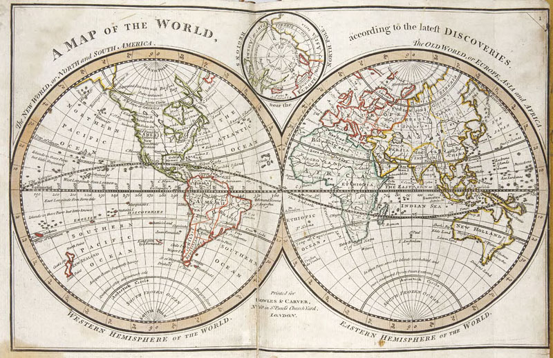
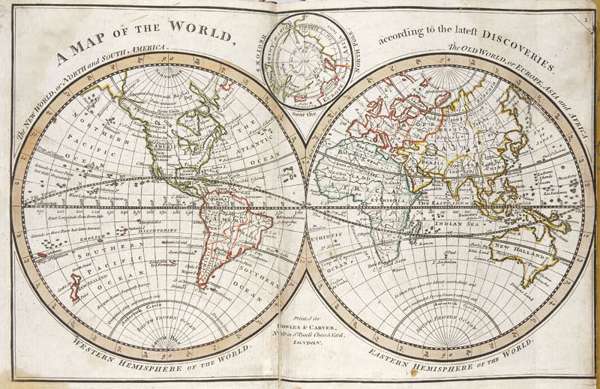
Bowles's Atlas Minor, containing a new and curious Set of Sixty-Five Maps. London: Carrington Bowles, [n.d., c.1763], 65 engraved maps hand-coloured in outline, one folding, 64 double-page, contemporary tree calf, sides a little worn, split to world map neatly repaired without loss, strengthening of folds of England map on verso
Footnote: According to Lister Moll's Atlas Minor was first issued in London in 1729 with later additions appearing as ''Bowles's Atlas Minor''. The world map shows the hypothetical east coast of Australia and Tasmania as joined. The map of North America is described as being ''a new map... according to the newest observations''' but does not show the alterations to the boundaries of Carolina, &c., in the light of the treaty of 1763. A fine clean copy.
Provenance: W. Scott, inscription on title verso; Scott of Harden, bookplate.