Lot 51
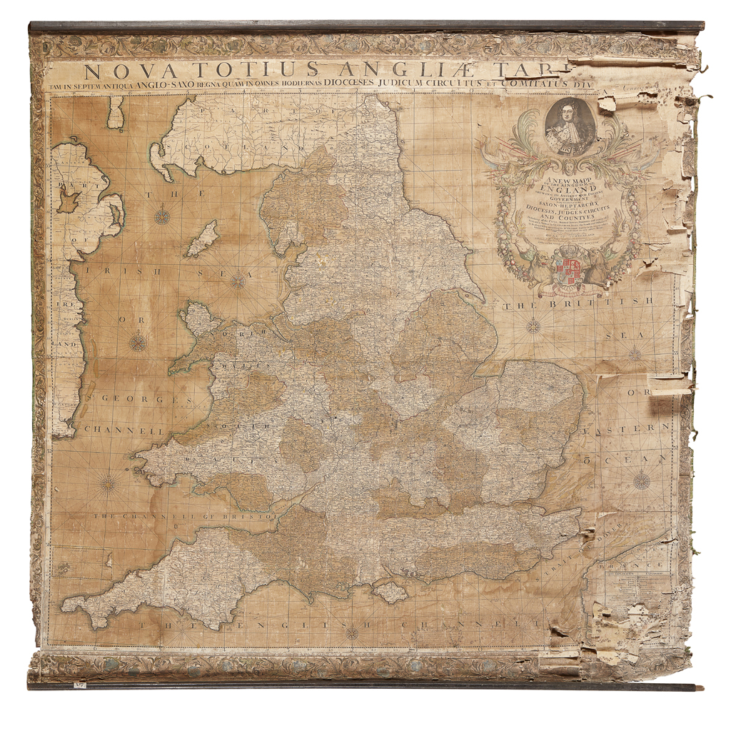
CHRISTOPHER BROWNE'S NOVUS TOTIUS ANGLIAE TABULA: A NEW MAPP OF THE KINGDOM OF ENGLAND
DATED 1735

Auction: 28 February 2018 from 11:00 GMT
Description
inscribed 'A New Mapp of the Kingdom of England, shewing Its Antient and Present Government being Divided as in the Saxon-Heptarchy also in the Diocesis, Judges-Circiutts and Countyes Describing all the Citys, Market Towns, Parishes and many of ye Villages, Nobile & Gentlemens Seats the Roads and Distances in Measured Miles according to Mr Ogilbys Survey with many other Additions and Corrections not Extant in any other Mapp. To His Hignnesse the Duke of Cumberland. This Map is most humbly Dedicated & Presented By his Highness most humble Servants Phil: Overton and Tho: Bowles. 1735.'
Dimensions
182cm x 178cm
Footnote
Note: Christopher Browne (fl.1688-1712) was apprenticed to Robert Walton and after his death in 1688 took over his stock. This map was first issued by Browne in 1700 and was to prove to be hugely popular being reproduced several times throughout the first half of the eighteenth century. Several examples are known with both his St Paul's address and that of the Royal Exchange. After 1712 the plates past to Philip Overton and Thomas Bowles as in this example, published in 1735.