Lot 53
Teesdale, Henry (publisher)
A New General Atlas of the World
Auction: 05 February 2025 from 10:00 GMT
Description
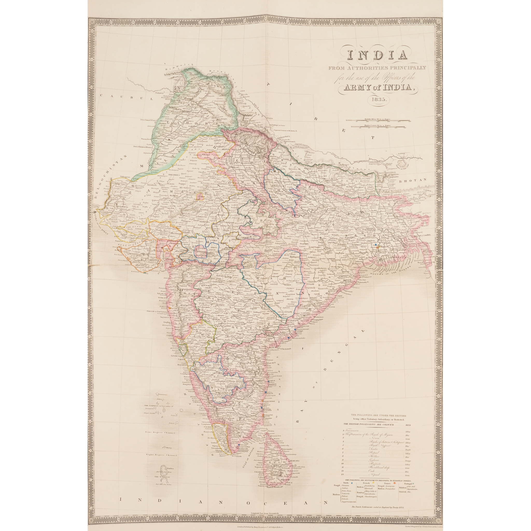
London: Henry Teesdale & Co., 1838. Folio, contemporary green half roan, engraved folding title-page, folding letterpress contents leaf, 46 engraved folding maps by John Dower, all hand-coloured in outline, one of which (‘India, from Authorities principally for the Use of the Army of India, 1835') on two sheets and opening to 70.5 x 44.5cm (with short split to edge of transverse fold), the remainder opening to 37.5 x 47cm, engraved double-page plate 'A Comparative View of the Heights of the Principal Mountains and Lengths of the Principal Rivers of the World, maps including ‘Birman Empire and Countries South East of the Ganges’, ‘China and Japan’, ‘Colony of New South Wales’ (with inset map of the Swan River Settlement), ‘Van-Diemans Land' (finger-soiling to margin), ‘Chart of the Pacific Ocean’ (short split to foot of central fold), and several dedicated maps of the Americas, shallow damp-stain to head of gutter never affecting images, binding worn, front board detached;
Wilkinson, Robert (publisher). Atlas Classica. Being a Collection of Maps of the Countries mentioned by the Ancient Authors both Sacred and Profane. With their Various Subdivisions at Different Periods. London: Robt. Wilkinson, 1797. Large 4to, contemporary half diced russia, engraved title-page, 35 engraved hand-coloured maps and engraved hand-coloured folding chart (collation not established), contemporary manuscript numbering to margins, binding worn, front board detached, title-page slightly soiled, small chip to lower margin of first map (2)
Provenance
From the library of the Murrays of Dollerie, Crieff, Perthshire.