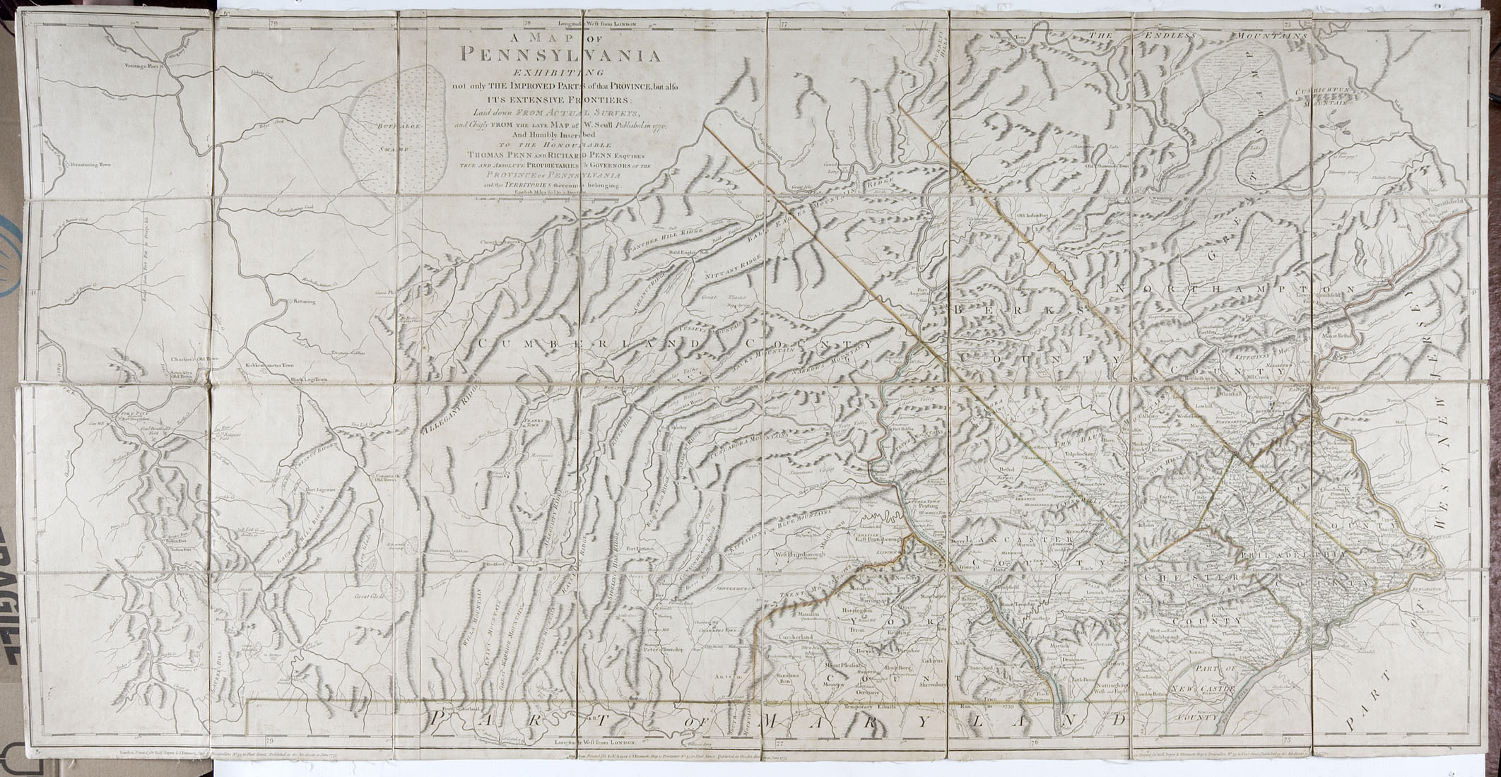
Pennsylvania - Scull, William
£900
Rare Books, Manuscripts, Maps & Photography | 483
Auction: 11 January 2017 at 11:00 GMT
Description
A Map of Pennsylvania exhibiting not only the Improved Parts of that Province but also its Extensive Frontiers: laid down from actual surveys. London: Robert Sayer & J. Bennett, 10 June 1775. Engraved map, hand-coloured in outline, dissected and backed on linen, 1370 x 714mm.
Footnote
Note: William Scull's seminal map of Pennsylvania, a map often referred to as the 'Revolutionary War map' of the state, was the most comprehensive and accurate map of Pennsylvania to that date. Scull's map of Pennsylvania, which covered the state from Philadelphia west to Fort Pitt, was based on his own work and on that of other surveyors, including his grandfather Nicholas Scull (1687-1761), who was surveyor general of Pennsylvania from 1748 to his death (Garrison, 277-79). The first edition of this map, issued in small numbers, is extremely scarce. Five years later, Sayer and Bennett issued this further updated edition in Jefferys's North American Atlas of 1775.